MetaChat REGISTER   ||   LOGIN   ||   IMAGES ARE OFF   ||   RECENT COMMENTS


artphoto by splunge
artphoto by TheophileEscargot
artphoto by Kronos_to_Earth
artphoto by ethylene

Home

About

Search

Archives

Mecha Wiki

Metachat Eye

Emcee

IRC Channels

IRC FAQ


 RSS


Comment Feed:

RSS

11 December 2007

Google Earth Who else here actually uses it for work?[More:]

I have found myself, in discussions about sites, saying, "just a sec," and pulling up the site on Google Earth. We have aerial photos of everything on the wall, but it's cool to just put it on the screen, and do the talking and finger-pointing around a desk.

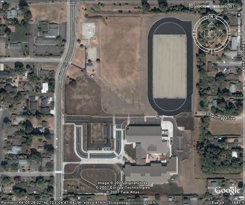
(The pic in question is of a school under construction. An earlier version had both the old school and the new school in place, but this updated one was after the old building got turned into a parking lot.)

It sorta impresses people also, if they have not seen GE.

Anyone else do anything like this?
I've used it to give directions where I wanted to show a street-level view of the building's elevation or something like that. Works a charm.
posted by lonefrontranger 11 December | 12:19
GE, and G Maps, are both really useful for planning errands and finding places around town. Also, have used a pedometer hack to find out how far my speedmarching route is.
posted by PaxDigita 11 December | 12:28
Some of the guys in our real estate investment group have wow'd our investment committee by opening up GE during approval meetings and giving "tours" of properties underlying mortgage-backed securities.
posted by mullacc 11 December | 13:05
Actually, I do. There is a nice interface where you can project results from a global climate model on Google Earth and navigate using GE capabilities. You are able to "project" cloud activity, hurricanes, storms, sea level rise, rainfall, dust storms and whatever other output a model gives onto real terrain. I project ocean model results. Boy, the little islands I have flooded...
posted by carmina 11 December | 13:11
I have wanted to find that giant island of floating trash in the ocean but have been disappointed each time!
posted by craniac 11 December | 13:17
Not for work, per se, no. I use it for mapping bike trails and planning places I want to go photograph.
posted by CitrusFreak12 11 December | 13:42
I have a couple friends who work in GIS and they use it all the time.
posted by fallenposters 11 December | 14:12
carmina -- where is that global warming interface? That sounds fascinating!
posted by psho 11 December | 14:15
No, it is not a "global warming" interface. We create climate model output, plot it on a latitude-longitude grid using a usual plotting interface (such as matlab, idl etc) and then import it into GE using the lat-lon coordinates it provides.

You may want to find more info and pictures in this website. I will try to find some open access demo versions for you, it's really neat.
posted by carmina 11 December | 14:25
okay, here is what I could manage to get online: GISS-temp. These are not model results, but they are the actual measurements on which estimates of global trends are based. Need to save the .kml file on your disk and use google earth to open it. Knock yerselves out!
posted by carmina 11 December | 14:53
I used to use it to show freight companies that a delivery location was commercial instead of residential. I also used it to get the names of all the places and buildings I took pictures of while we were in London.
posted by youngergirl44 11 December | 20:42
I use it to find cemeteries way out in the country.
posted by ColdChef 12 December | 00:12
Gary Taubes speaks at Berkeley || Too soon??

HOME  ||   REGISTER  ||   LOGIN